Gully Inventory and Condition Assessment
Estimated Timeline: Spring 2020 - Summer 2023 Estimated Cost: $193,400Using the Minnesota River as a focal point, the Lower Minnesota River Watershed District (LMRWD) has spent years examining issues facing the river’s complex natural system, which is a shared resource and a place where varied interests and other systems converge. Gullies are landforms created by running water, eroding sharply into soil, typically located on a hillside. They can resemble large ditches or even small valleys, but with much smaller drainage areas. Without intervention, gullies with actively erode upstream, transporting sediment to downstream waters.
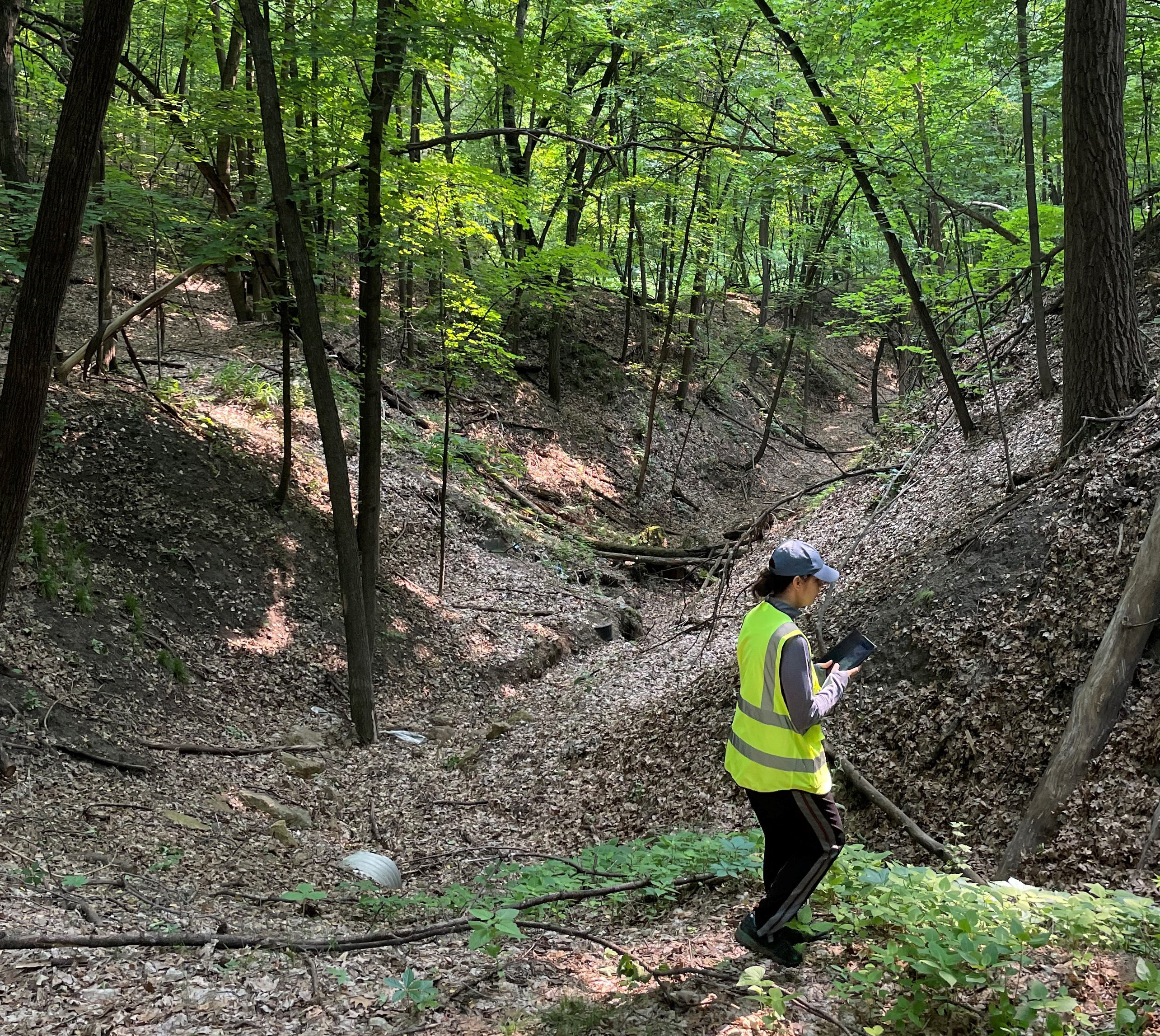
The gully reports examine pressures on the Minnesota River from inside the watershed and expand to consider areas upland of the watershed. Fieldwork has been conducted over several years to inventory gullies in the watershed and prioritize them based on their potential for loading sediment into the Minnesota River. To assess gully conditions, the LMRWD has employed interns to perform field data collection during the summer. The students identified potential gully locations using GIS software and then assessed potential gully areas and conditions in the field. As part of Phase II, Young Environmental Consulting Group employed two interns who completed a summer project on gully inventory and assessment. The interns found 257 new gullies, which were broken down into low, moderate, and high priority corresponding to the erosion potential of each site. Data from these assessments were compiled into the 2020 Updated Gully Inventory and Condition Assessment. Another phase of the project work was completed in 2021, when interns continued work on gully identification by investigating areas not surveyed in past work (2008 and 2020).
As part of ongoing research and management plans, three new interns performed additional gully assessments in the summer 2023 season. The latest stage of analysis will determine the primary areas of flow and sediment contribution into the Minnesota River between the City of Carver and the confluence with the Mississippi River, while formulating management and restoration strategies to improve the areas of concern in the future.
Project Resources
2023 Gully Inventory and Condition Assessment
2023 Gully Inventory and Condition Assessment, August 9, 2023
August 16, 2023 Board presentation
2021 Gully Inventory and Condition Assessment
2021 Gully Inventory and Condition Assessment, Volume 2
2020 Updated Gully Inventory and Condition Assessment
- Table of Content and Executive Summary
- Introduction
- Gully Background
- 2008 Inventory Assessment and Data Review
- Field Data Collection
- Bloomington
- Carver
- Chanhassen
- Chaska
- Eden Prairie
- Jackson Township
- Lilydale
- Mendota
- Mendota Heights
- Next Steps
- Bibliography
2020 Updated Gully Inventory and Condition Assessment workplan
Project Contact
For more information about this project, contact:
Linda Loomis
naiadconsulting@gmail.com
763-545-4659