Spring Creek Erosion Control
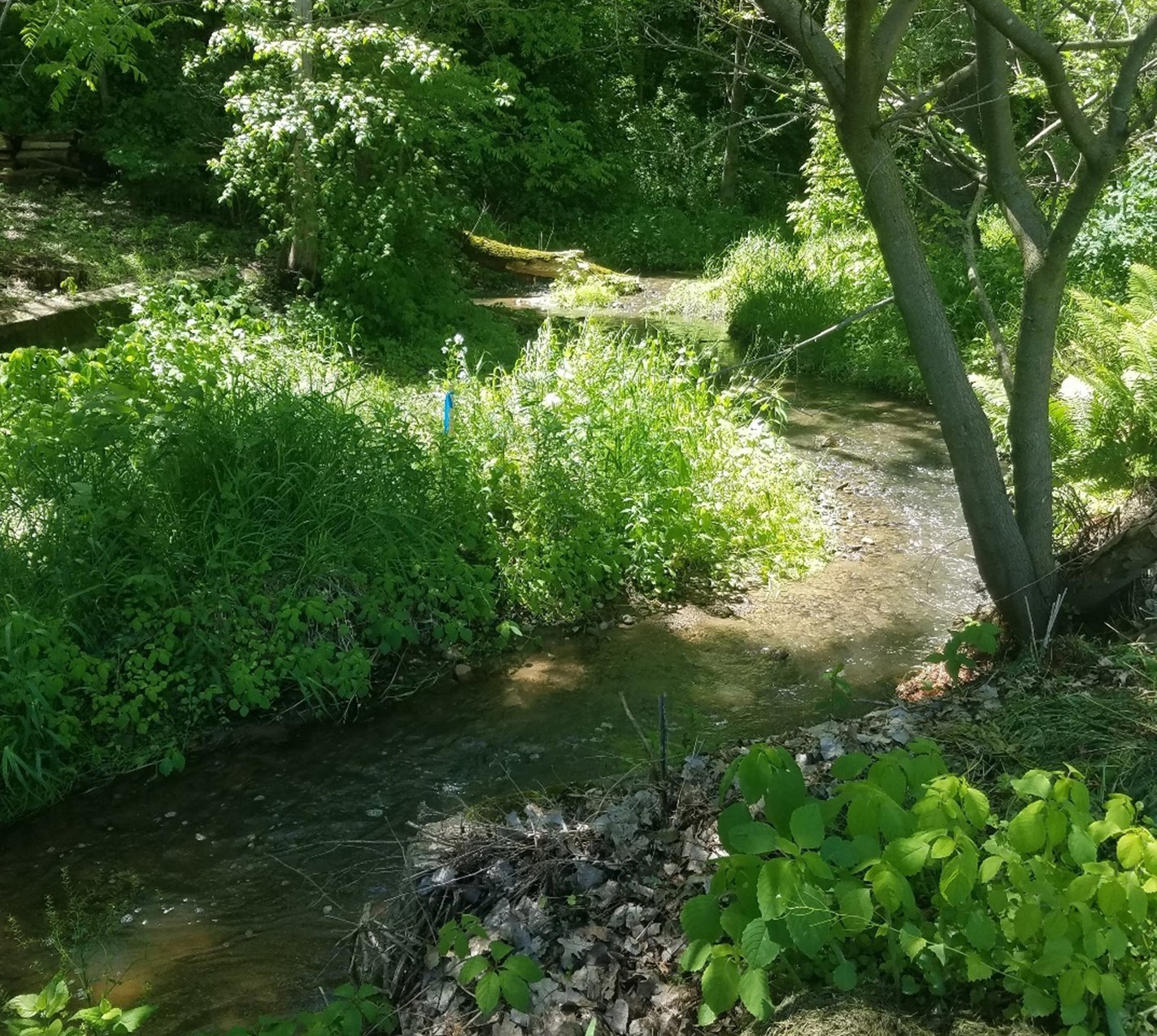
Estimated Timeline: 2018-Present Estimated Cost: $352,000Spring Creek is a dynamic creek that has adapted to a changing environment since the 1800s. Exponential growth in the 1850s caused Spring Creek to transition from being a natural, untouched system to being confined by the development of the downtown region, multiple new crossings, and the adjacent river bluffs. Because of this rapid development, the Spring Creek system and upstream landscape experienced substantial erosion and did not reach equilibrium until the 1940s. Due to new development in recent years, runoff water from the watershed entering Spring Creek has increased runoff leading to increased erosion of the creek’s bank. The Lower Minnesota River Watershed District (LMRWD) is concerned with Spring Creek as a source of sediment to the Minnesota River. Additionally, in 2018, two residents raised concerns of its impact to private property.
The Carver Soil Water Conservation District (SWCD) evaluated the sites. Solutions proposed by the Carver SWCD included reinforcing the stream banks with vegetated retaining walls, vegetated riprap, and native plantings to hold the soil in place. Residents reached out to the LMRWD for cost-share funding and a review of the proposed plans. In June 2019, a site visit was conducted and a hydrology assessment was recommended. The LMRWD completed the hydrology assessment in 2022 to better understand historic changes and anticipate future conditions to determine the appropriate stabilization measures.
The assessment provided the following recommendations: (1) exploring the need for a larger project by studying how long erosion has been occurring and where it is occurring, (2) conducting routine monitoring of the creek to acquire more data on erosion and sedimentation rates entering the Minnesota River, (3) remove invasive vegetation in the floodplain and channel banks to encourage resilience to erosion, (4) prioritizing restoration at the most at-risk sites, (5) continuing monitoring efforts and reevaluate the need for restoration, and (6) continuing coordination with the City of Carver on the proposed levee to determine impacts on Spring Creek erosion.
In 2023, the LMRWD advanced two of the sites for bank stabilization practices, which were designed to the 60 percent level. The LMRWD
submitted a wetland delineation to the US Army Corps of Engineers. The LMRWD studied the third site further but determined that a project was not needed because of low erosion potential. The LMRWD will continue to work with the homeowner, by providing a steep slopes
management plan for the site.
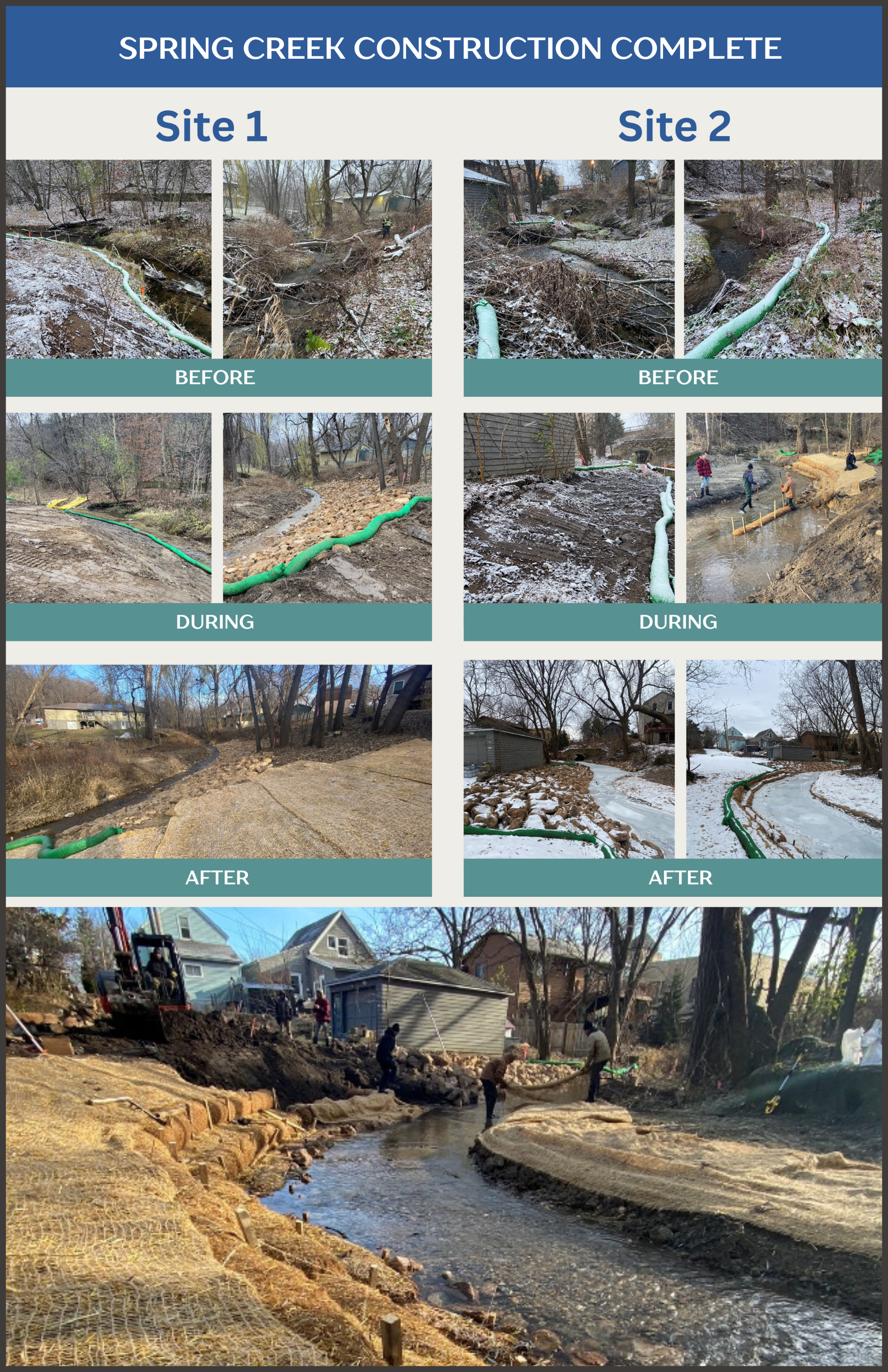
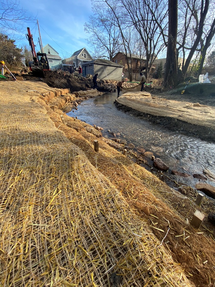
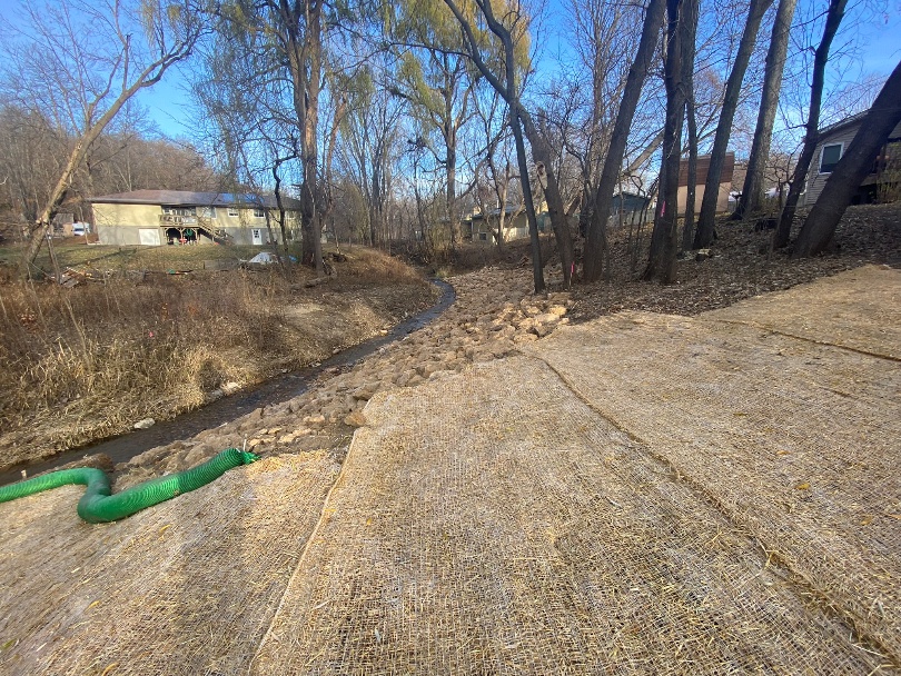
Construction activities included vegetation and tree removal and clearing on the creek’s banks, removing downed trees and debris within the
stream channel, installing rip rap, live stakes, and coir log benches, and bank grading and revegetation.Construction took place in 2024 and was completed in November. There are numerous benefits to the Spring Creek ecosystem and surrounding private property, including slower creek velocity to reduce erosion and downstream sedimentation; protection for private property such as garages; and larger stream bend for natural creek flow.
Project Resources
Level 2 Wetland Delineation_Oct 6 2023
Spring Creek Hydrology Review_Jan 15 2022
Video of Spring Creek During Rain Event_June 9 2018
Project Contact
For more information about this project, contact:
Linda Loomis
admin@lowermnriverwd.org
763-568-9522
Project Partners
Carver SWCD
Spring Creek Residents