State research offers fresh look at a troubled Minnesota River
Posted: 08/20/19
Several TMDL (Total Maximum Daily Load) and WRAPS (Watershed Restoration and Protection Strategy) reports addressing pollution in the Minnesota River Basin are open for public comment now. Please review the full reports at the links below. Public input can make study and strategy reports better, by providing additional information and ideas for implementing changes to reach water quality goals.
The data suggest that the MInnesota River, which flows 335 miles from Big Stone Lake in South Dakota to the Mississippi River at Fort Snelling, is in need of some big changes if the state's water quality goals are to be met.
All the studies will be open for public comment until 4:30pm Friday, September 20.
Here’s a brief summary of the state’s four recent updates on the River.
1. The Lower Minnesota River WRAPS
The Lower Minnesota River Watershed covers about 1,760 square miles of land, including the lower reach of the Minnesota River as it flows into the Mississippi River at the confluence at Fort Snelling. The state has completed a multi-year effort to collect data on 103 lakes and 117 stream sections in the lower portion of the Minnesota River. The report found some troubling results:
- 84% of streams didn’t meet standards for supporting fish and other aquatic life
- 95% of streams had unsafe levels of bacteria
- 55% of lakes were impaired for excess nutrients (phosphorus and nitrogen)
- 46% of lakes had elevated levels of chemical pollutant PFOS (Perfluorooctanesulfonic acid)
- 90% of wetlands have been drained
2. Sediment pollution in the Minnesota River & Greater Blue Earth River
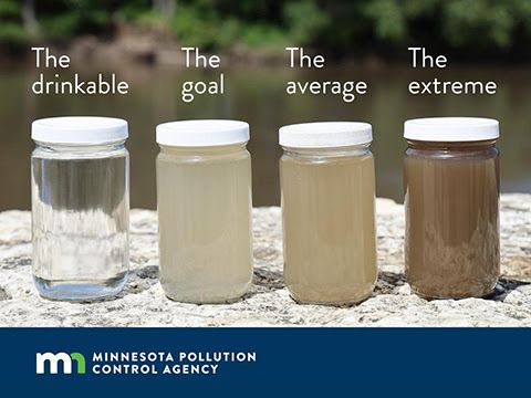
A second report examines streams in the Minnesota River and Greater Blue Earth River basin. Data show that these streams suffer from high turbidity: soil and other particles suspended in the water that block light and make it difficult for fish and other aquatic life to thrive.
In aggregate, the state found that sediment reductions of 50% are needed. That reduction goal can be met through a mix of water storage, drainage water reforms, stream bank protection and widespread changes to our cropping systems to hold more water and soil on the land.
3. Restoring the Watonwan River
The Watonwan River drains about 878 square miles of mostly farmland in south-central Minnesota. The state recently completed an Total Maximum Daily Load Study (TMDL) and has crafted a Watershed Restoration and Protection Strategy (WRAPS). The WRAPS calls for significant pollutant reductions, including:
- 50% reduction in nitrogen
- 40% reduction in phosphorus
- 65% reduction in bacteria
- 20% reduction in sediment
- 25% reduction in peak stream flows
4. Restoring the Minnesota River-Mankato
The Minnesota River-Mankato watershed drains about 861,0000 acres of mostly agricultural land that flows directly into the Minnesota River in eight counties in south-central Minnesota. The state completed a TMDL Study and WRAPS report for this area as well. It also calls for similar pollutant reductions, including:
- 60% reduction in nitrogen
- 50% reduction in phosphorus
- 60% reduction in bacteria
- 50% reduction in sediment
- 25% reduction in peak stream flows